
Street litter data, free for anyone.
Every record is one photo taken in the Rubbish app, with when, where and what was in it. Explore each project on a map, or download the data.
Projects
Each page tells one project's story, checks what was said about it against the data, and replays the records on a map.
Polk Street
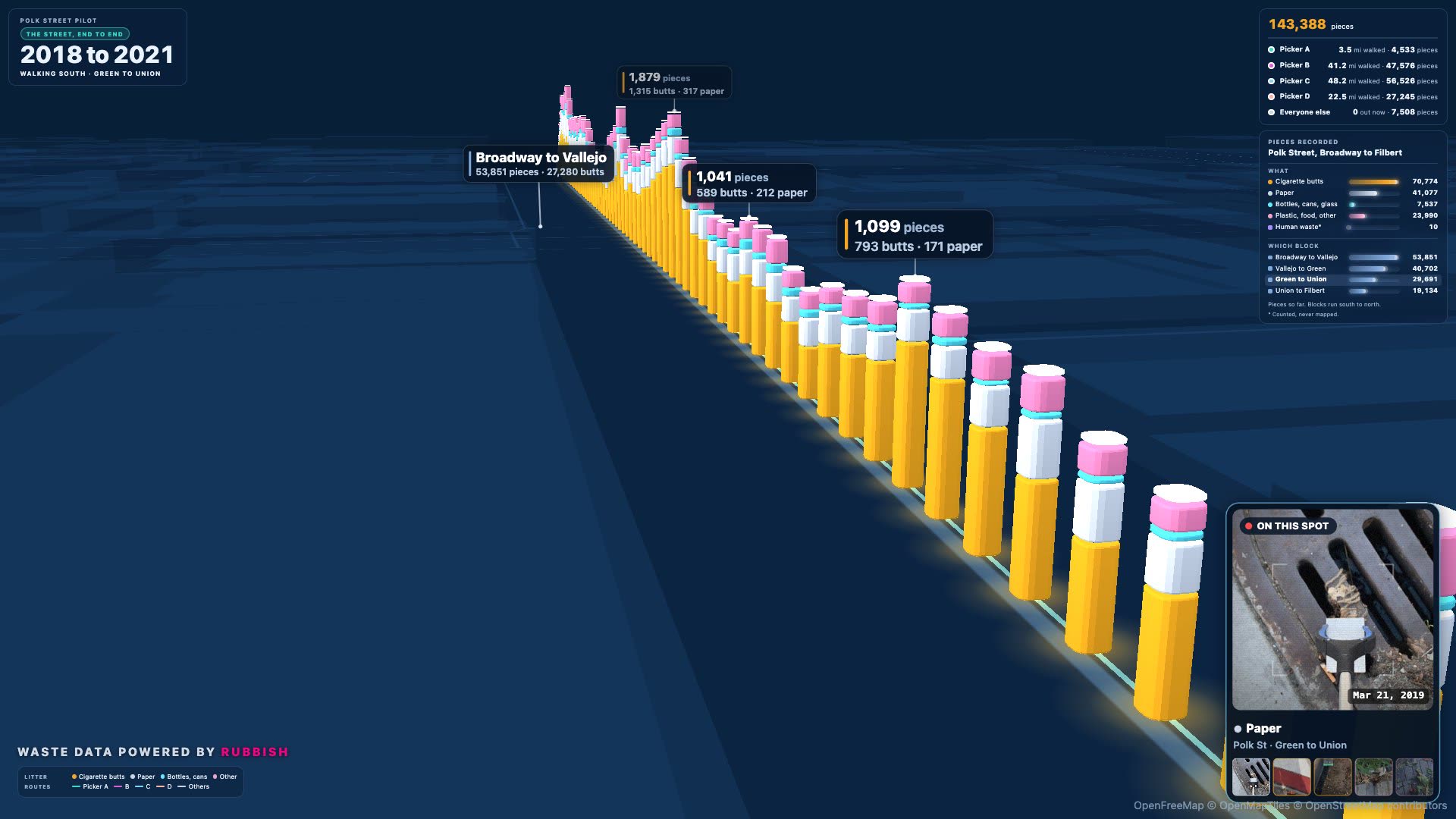
On four blocks of Polk Street, we recorded 143,388 pieces of litter. Half were cigarette butts.
Discover Polk
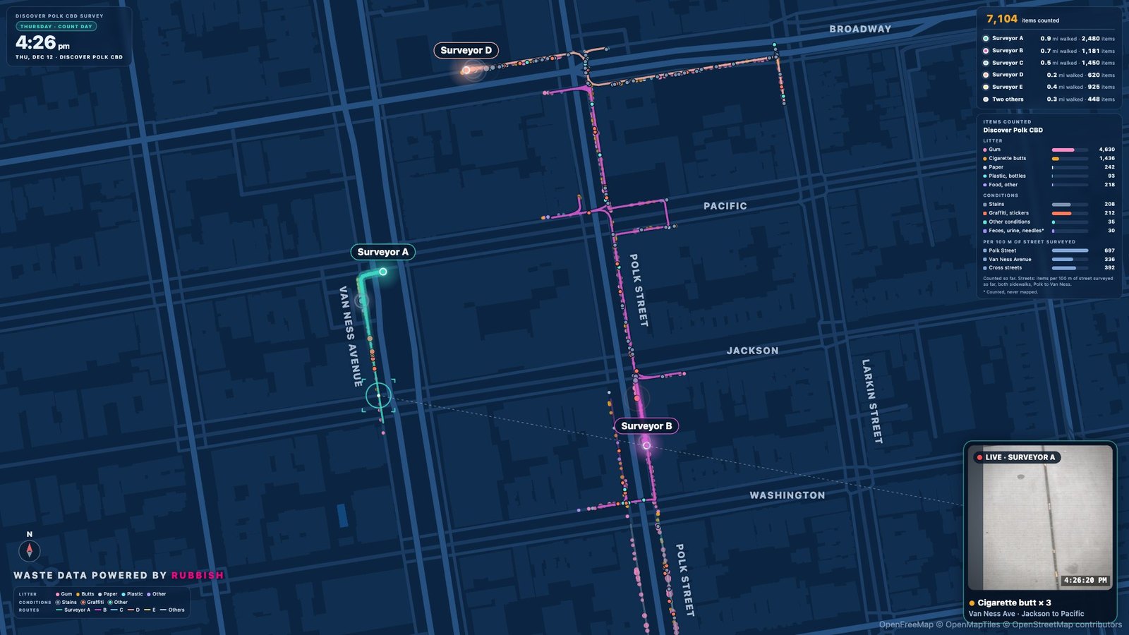
In the Discover Polk CBD, 64% of what a December 2019 survey counted was gum.
SoMa West
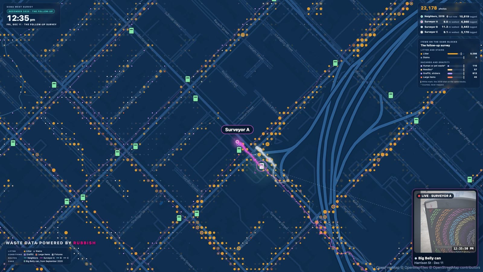
On the same blocks, human and pet waste fell 85%. Litter rose 19%.
River District
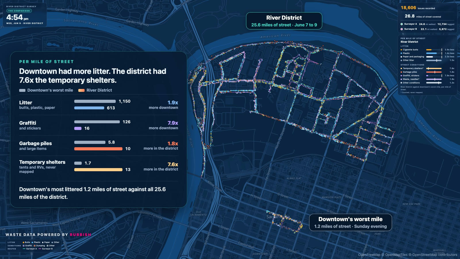
Downtown had more litter. The River District had 7.6 times the temporary shelters.
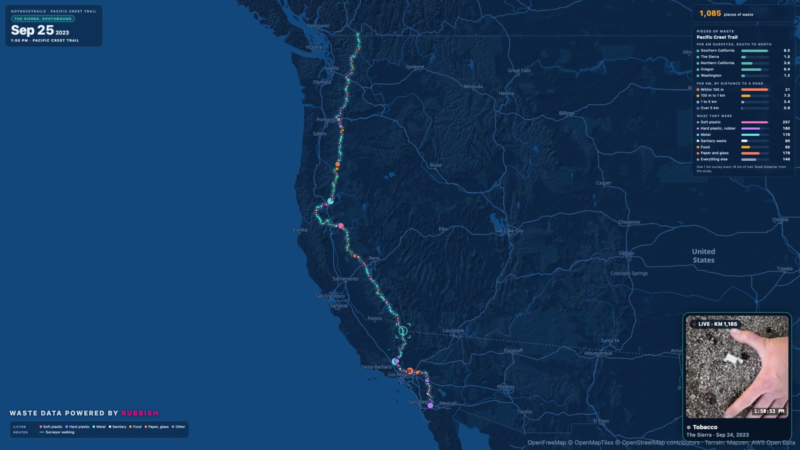
Wasted Wilderness
On the Pacific Crest Trail, the trash was by the roads: 20.5 pieces per km within 100 m of one, 0.9 more than 5 km away.
Events
Litter recorded where crowds gathered, from a Y Combinator lecture to a regional burn.
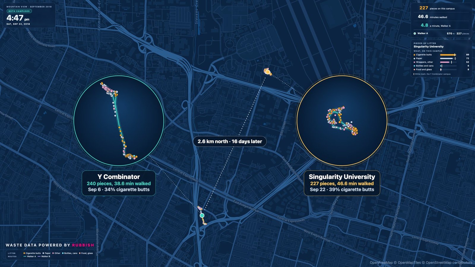
Two startup campuses, 16 days apart: 240 pieces of litter around Y Combinator, 227 at Singularity University
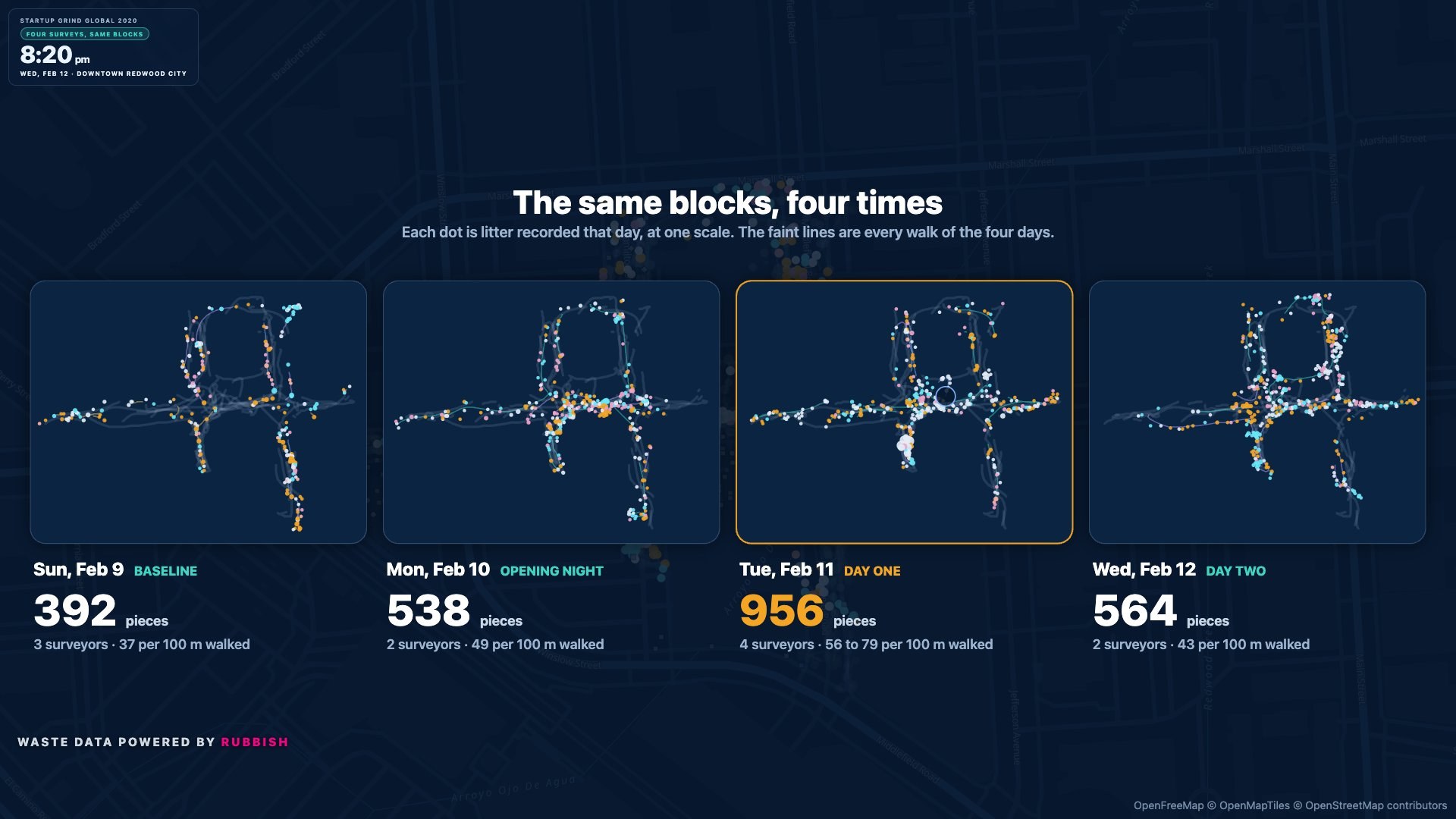
Day one of Startup Grind 2020 left 1.5 to 2.1 times the baseline's litter per 100 m of street.
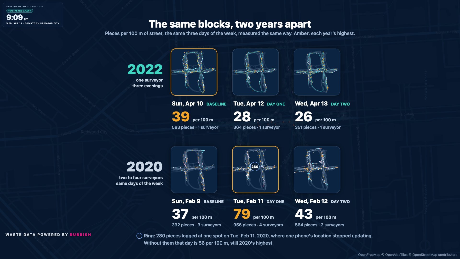
Around Startup Grind 2022, the Sunday before had the most litter.
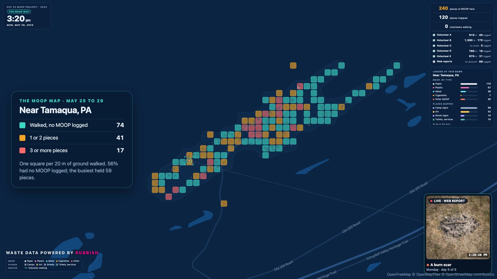
316 pieces of MOOP at two regional burns, mapped by a volunteer team in 2023
Get the data
One CSV per dataset, the same columns in every file. Everything is on GitHub with a column guide and a note on how the data was collected and cleaned.
| Dataset | Records | File | About it |
|---|---|---|---|
| Polk Street and Discover Polk, San Francisco | 145,925 | polk-street-2018-2021.csv 27.2 MB | Notes |
| SoMa West, San Francisco | 36,575 | soma-west-2018-2024.csv 7.2 MB | Notes |
| River District, Sacramento | 18,606 | river-district-audit-2021-06.csv 3.6 MB | Notes |
| Pacific Crest Trail (NoTraceTrails) | 913 | pacific-crest-trail-2023.csv 0.2 MB | Notes |
| Events, 2018 to 2026 | 9,302 | events-2018-2026.csv 1.8 MB | Notes |
All files on GitHubColumn guideHow it was collected
What is in the files
No names, emails, account ids, photos or photo links. Locations are rounded to about 11 m, and to about 110 m for tents, shelters, RVs, needles and most human waste records.
The maps on these pages draw each walk from the phone's GPS, so they are more precise than the files.
How to cite
Free to use, share and adapt under CC BY 4.0, with credit:
Rubbish (2026). Rubbish Open Data: street litter and street-condition records, 2018 to 2026. https://github.com/eminisrafil/RubbishOpenData
Original studies and data
Some of these projects were led by others. Their studies, data and code come first; ours is the app export. Each project page lists its own sources too.